|
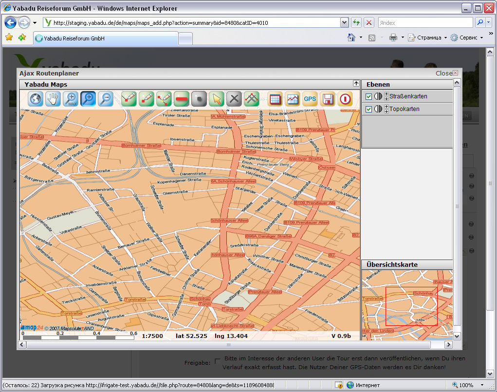
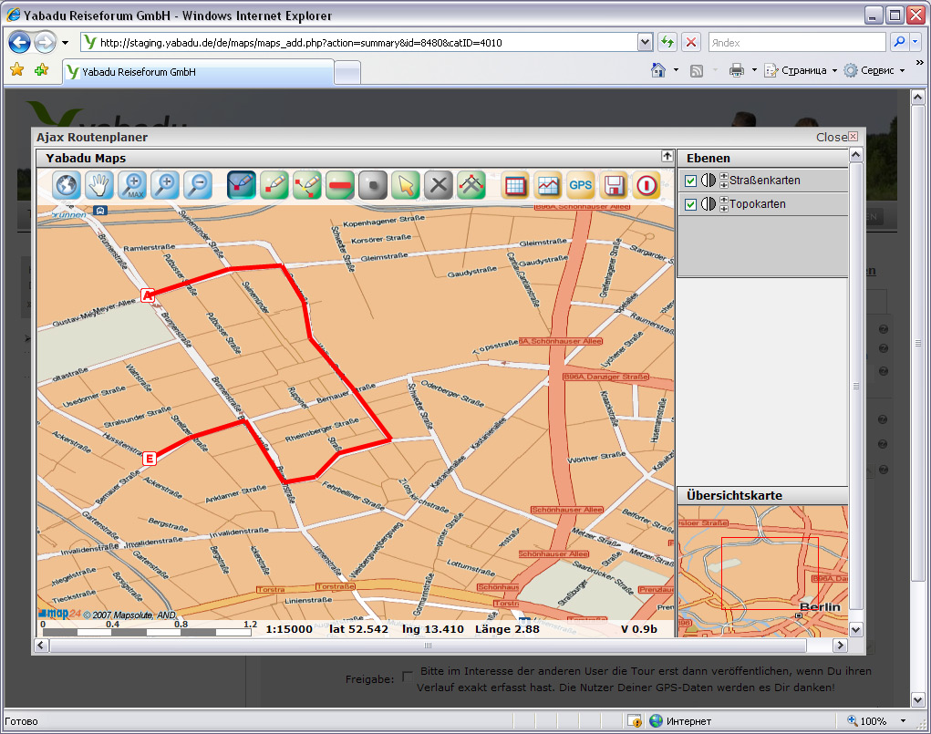
Yabadu Maps is an Internet Software Application to create and store Tracks using Topographic Map. It was created using AJAX technology to increase interactivity level.
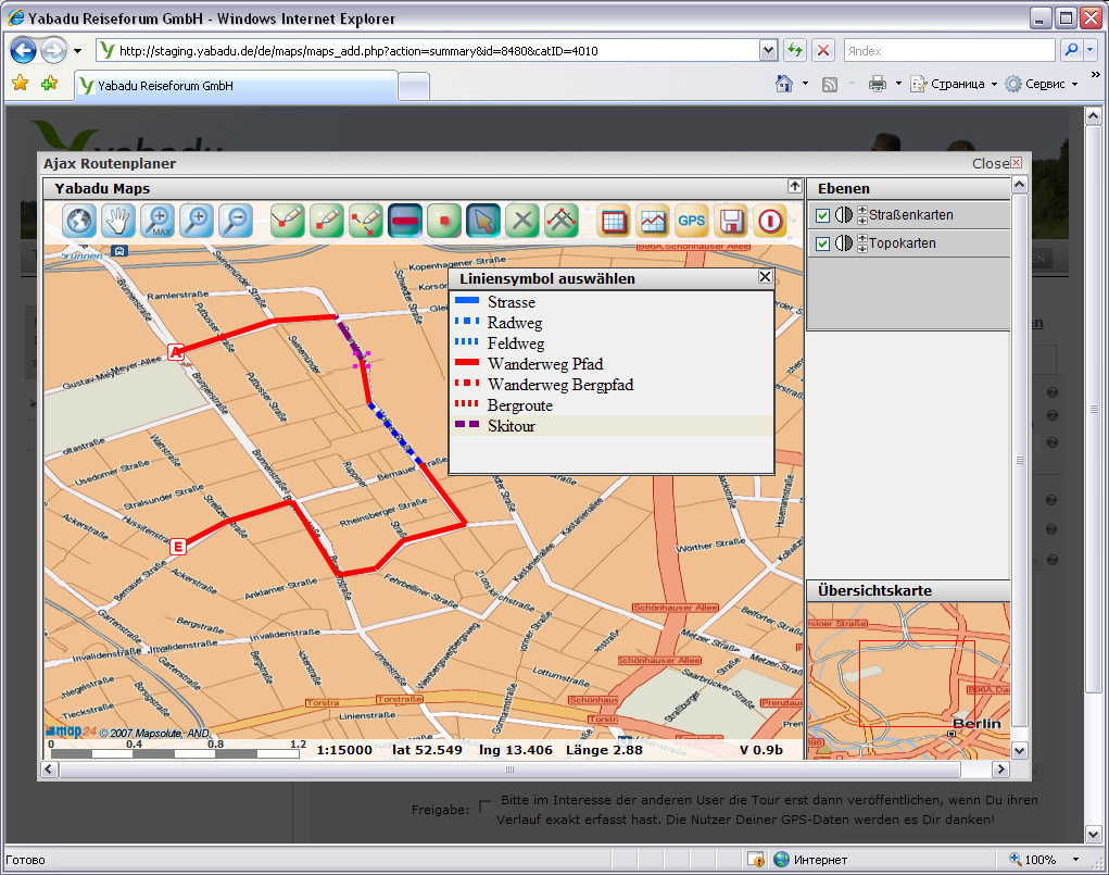
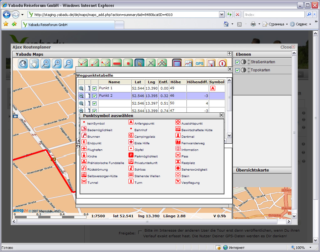
It allows create route using vision editor, set waypoints, points of interests (POIs), insert route point, change line style, create altitude profile, import of GPS-Tracks as GPX-File, switch between Street Map Layer and Topo Map Layer, etc.
AJAX client is working with UMN MapServer and its geospatial data to show topographic map, it also uses Mapsolute service to work with streetmaps.
|